
| Gravimetric Observations Research Infrastructure Center - CIBOG |  |
|
Entity responsible: Institute of Geodesy and Cartography (Centre of Geodesy and Geodynamics) Entities implementing: Institute of Geodesy and Cartography (IGC) |
The aim of this task is to create the first modern database of gravimetric observations in Poland. Because this is the first database of this type it is very important to organize the work within the frames of the task concerning the communication with gravimetric society in Poland and abroad in order to determine a proper operation ability of the database. The data repository will be referred to as GRAV-PL.
The database will gather relative and absolute gravimetric observations (from the territory of Poland) as well as continuous tidal recordings from the gravimetric measurement infrastructure developed under the project. The database will also contain time series of products of satellite gravimetric missions (GRACE, GOCE). The data set will cover both archived gravimetric observations time series as well as new acquired data. The gravimetric data gathered in the database will be organized, processed and made available online for the wide range of users.
As part of data organization process it is planned to establish unified data storage formats based on solutions used in international databases of the International Association of Geodesy (IAG). It is also planned to complete the functionality of database with the possibility to create visual images and obtain finished products generated based on gathered observations. For the needs of the GRAV-PL repository operation, disk arrays with necessary hardware and software will be purchased.
Figure 1 presents a map of final infrastructure of tidal gravimeters. The data from these gravimeters will be collected in real time and further will be processed within the GRAV-PL repository. The infrastructure covers at least 8 gravimeters in 7 locations. Within the project, the purchase of three gPhoneX spring gravimeters is planned. Two of them will be located on the MUSE fields and one on the campus of the Wroclaw University of Environmental and Life Sciences.
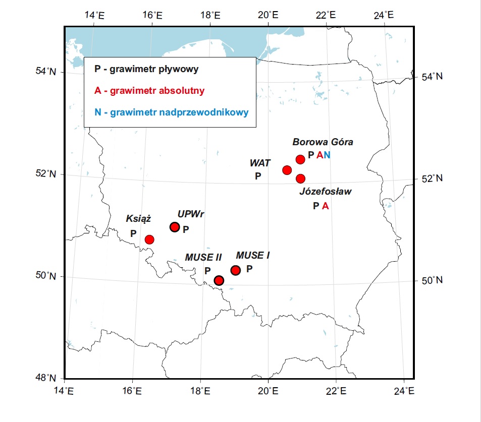
Fig. 1. Map of the target infrastructure of tidal gravimeters;
An example of updated tidal changes recorded with the use of the LaCoste&Romberg gravimeter model G1036 at the Borowa Gora Observatory are available on the Observatory’s website (link: http://bg.igik.edu.pl:11180/LR1036/).
Activities within task 6 are closely related with Institute’s participation in tasks 8 and 9 where IGiK essentially supports preparations to tidal and absolute gravity observations on MUSE polygons. In order to unify the tidal datasets withinthe GRAV-PL repository, a uniform method of calibration will be implemented for all of the tidal gravimeters, participating in supplying the repository with data.
In the frames of tasks 8 and 9 IGiK will perform various measurement campaigns on MUSE polygons, with the use of the A10-020 absolute gravimeter. During 5 years (2017-2021), 13 gravimetric measurement campaigns are planned. The absolute gravity measurements will determine the reference level for the differential gravity measurements performed by the Central Mining Institute also within task 9. The schematic map of planned absolute gravity measurements performed with the use of the A10-020 gravimeter as well as relative gravimetric measurements is presented in Figure 2. Results of these measurements will also be included in the GRAV-PL repository.
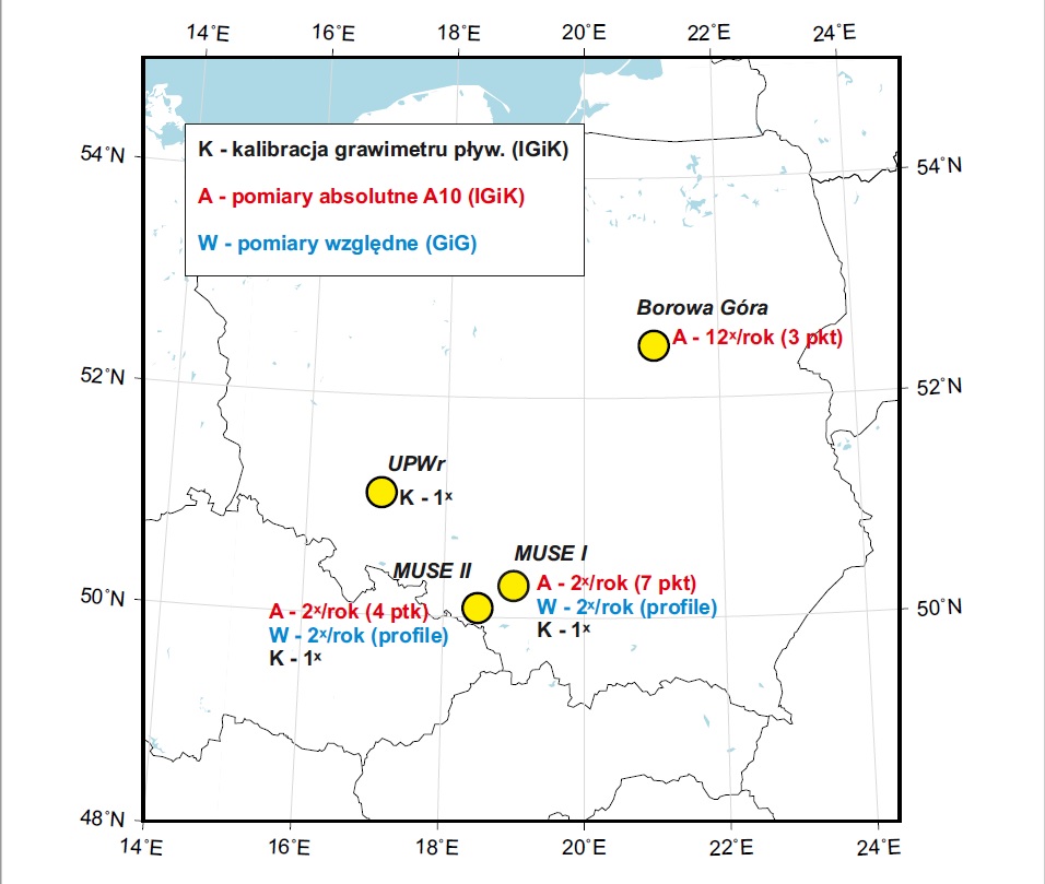
Fig. 2. Schematic map of planned absolute gravity measurements with the A10-020 as well as relative gravity measurements.
˟ˣ